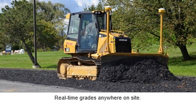
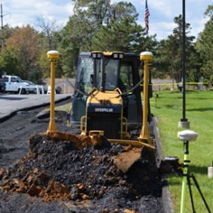
GPS Machine Control is used to accurately position earthwork machinery based on 3D design models using GPS systems and thus aid machine operators to control the position of a road grader’s blade.
 GPS, when applied in the earthmoving industry, can be an asset to contractors and increase the overall efficiency of the job. The key to successfully using GPS is having an accurate site design. The site design is typically created by a surveying or engineering firm. Whether we are working with our own “in-house” design plans or CAD files from another firm, we can import the design, analyze the design and manipulate the data. We use tools to modify and edit the line drawings and create a surface model that represents the proposed design for the site.
For machine control to operate successfully, the surveying infrastructure needs to be reliable. Without stakes, laths, ribbons and markers, a machine operating on the site can wreak havoc if a dependable network of surveying control doesn’t exist. Reliable surveying control is necessary at the site to ensure that the “digital staking” is properly set and immovable. Having surveyors who understand the needs of machine control is critical. A surveyor needs an understanding of the datum in order to coordinate the data system project-wide. This involves focus on the part of the surveyor, who must consult with the designers and contractors to ensure that all are indeed “on the same page.” Without good control, it is not possible to check the calibration and accuracy of the machines, which in effect have become giant surveying machines, or at least extensions of a large, integrated surveying system.
 The model itself relies on accurate design plans. Inaccuracies or lack of data in the design plans must be recognized and corrected prior to finalizing the 3D model. The preparation of an accurate model requires an experienced professional. An inexpensive 3D model will cost a contractor much more time and money in the field once the inaccuracies become painfully evident.
Ott Consulting provides accurate, affordable 3D Data Prep Models for Engineers, Land Surveyors and Contractors for Machine Control, Construction Stake-out, Grade Checking, Earthwork Progress Quantities and Stockpile Verification. Recently, Ott Consulting prepared a 3D model for the complete reconstruction of a 9 acre parking facility. Because of our past experience with preparing a proper 3D model, this project went smoothly.
— Reynold E. Petre, P.L.S., P.D.C.